 Geysers Valley
Breakfast in the hotel. Leave your things in your room, as we return in the evening. Wear boots and outdoor gear. Have rain gear and a spare sweater in a day bag; no food is needed; keep clutter to a minimum as it will only be a pain in the helicopters. Leave in our own conventional bus, for the 45 minutes drive to the heliport, at Yelisovo, close to the main airport.
The helicopter flight to the Valley of Geysers takes about 75 minutes, on either of two routes. The all-weather eastern route heads around the southern and eastern flanks of Avacha, flying at heights of just a few hundred meters above ground if that is necessary to keep below any thick cloud cover. It continues north up a broad valley to theeast of the Zhupanovsky volcano; the low flying gives splendid views of the taiga landscape, and this valley is home to many brown bears, who may be easily seen from above. Over a low col, the flight approaches the coast, where a few hunters' cabins lie among the trees; Karymsky and the two Semlyachik volcanoes lie inland to the left. The flight then turns inland up the valley just before the Kikhpinych volcano, and turns into the lush green tributary which is the Valley of Geysers.
The western route heads round the western side of the smaller cones of Arik and Aag, which continue the line of volcanoes northwest from Koryaksky. It then heads across the interior tundra, keeping west of Zhupanovsky, on its way to Karymsky If the eruptions are still in Strombolian style, one should be seen on the flight past. The active cone is 700 m high, and stands inside an old caldera; the even older Dvor caldera is truncated as the higher bowl to the north. Just to the south, Karymsky Lake lies in the Academia Nauk caldera, which erupts less frequently. Northwards, the flight goes over Maly Semlyachik volcano with its spectacular crater lake of green water. Past the inactive Bolshoi Semlyachik, the route veers slightly right for the Valley of Geysers.
 Geysers Valley
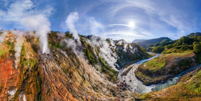
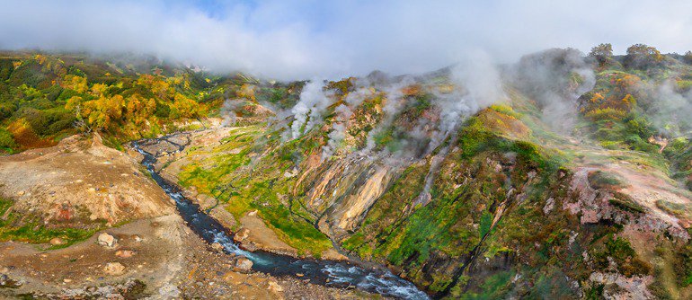
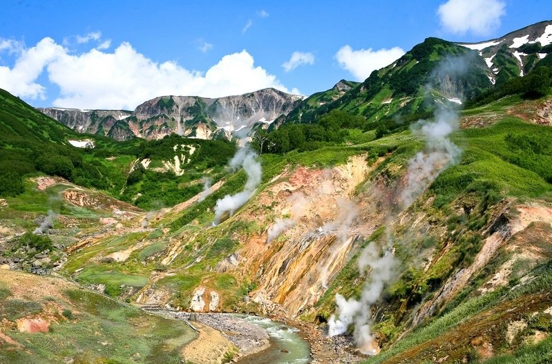
The cluster of geysers, fumaroles and hot springs in this valley were only discovered in 1941. They lie above the marginal fractures of the oldest Uzon caldera. The hot water that emerges is largely recirculated rainfall, mixed with some juvenile water from magma. The magmatic heat source is probably the roots of the Uzon volcano, where ground temperatures reach 250°C at about 500 m depth beneath the caldera floor; alternatively, the Kikhpinych volcano may be the heat source. The Geysernaya River has cut its valley into bedded andesitic tuffs that were deposited in a lake in the first Uzon caldera; the southeastern valley slope is the heavily eroded caldera wall, broken into older volcanic. Some dacite lavas and intrusions occur in the tuffs, and all the exposed rocks have been altered hydrothermally. Some slopes have been gullied to leave earth pillars. There are extensive deposits of opaline siliceous geyserite, some built into large banks and terraces below the main vents. The valley's geysers include a few with large but brief periodic eruptions, and many more which produce hot water spouts frequently or almost continuously.
The helicopters land in front of the timber lodge that is the access point for all visitors to the trails into The Valley of Geysers (Dolina Geyserov), within the Kronotsky Nature Reserve. Walkabouts in the valley are not allowed, so we will stay in a group.
The boardwalk leads to the lip of the valley for a fine overall view. The upper slopes of the valley expose cliffs of pomaceous tuffs, some eroded into earth pillars. The valley floor has a lush green plant cover, except where active banks of geyserite have not yet been colonized.
 Geysers Valley
A branch to the left ends at the Bolshoi (Big) and Maly (Small) Geysers. An eruption of Bolshoi, on the left, throws water about 10 m high amid clouds of steam, for about 10 minutes; it erupts on a cycle of about 75 minute. Maly Geyser throws water out at 45° for about 8 m, in eruptions lasting 5 minutes on a 35 minute cycle.
The main path descends to a bridge over the Geysernaya River a little further upstream. The river reaches a temperature of 26°C with its geothermal input in the summer; winter snow-melt reduces it to about 16°C. Water from the springs and geysers varies from 35°C to 100°C. Just upstream of the bridge, the Schell (Crack) Geyser erupts briefly every 35 minutes; it was heavily eroded during a typhoon flood in 1981. The Fountain Platform is a great bank of geyserite producing copious quantities of steam from numerous vents; it is claimed as the world's greatest concentration of geysers and fumaroles. On the platform. Malachite Grotto is a nearly permanent spouter erupting from a geyserite cone; the Fountain and New Fountain are connected so that they switch their water spouts every few minutes but combine to provide almost continuous activity.
The boardwalk ends before another old bridge. Velikan (Giant) Geyser is on the far bank, inside the bend of the river; it erupts with a cascade of water to heights of about 25 m, but only for about a minute, before sending steam jets to far greater heights for another few minutes; its cycle is around 8 hours. A trail on the terrace above the valley floor provides views down onto the Fountain Platform, and also passes various hot pools, blue with suspended clay, and boiling mud pots, red with iron oxides. Lunch is scheduled at the Valley of Geysers lodge.
 The Uzon Caldera
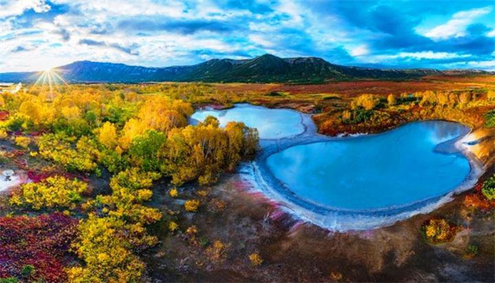
The Uzon depression is bordered to the north and west by steep caldera walls that have survived into the modern landscape. These are essentially features of the second in the series of three caldera collapses; the third (minor) collapse merely deepened the depression west of the heli pad that is now largely marsh ground and lake remnants on a floor of lacustrine sediments. The highest ground is formed by the basaltic cone of Uzon volcano, which stands above the western rim of the caldera. Immediately west of the heli pad, Bannoe Lake has a steam vent beneath it; this erupted in 1989, but is now quiet. The lake is about 30m deep, and its bottom 7m are a pool of liquid sulphur at a temperature of 140oC; large blocks of glassy black sulphur have been extracted byvolcanologists. It appears that the sulphur vent is similar to the black smokers of ocean floors.
Further west, trails wind across the marsh ground on the caldera floor to a variety of hot springs, boiling lakes and mud pots in the dacitic tuffs and lake sediments. Various of the hot springs have associated sulphur, opal, pyrite and mercury deposits. Most of the colouring at the spring sites is due to temperature-sensitive algae.
Towards the east, a trail leads through alder bushes up the Belaya dome; this is formed of slab-jointed dacite porphyry that varies from dark lava and tuff to glassy obsidian and light pumice. Some is hydrothermally altered, with kaolinite, opal, alunite and sulphur. Adjacent to Belaya, there are two small acid lakes with pH of 2. Further north. Lake Dalneye is nearly 1 km across, in a splendid maar crater fringed by a tuff ring of very scoriaceous basalt; it was produced by the modest steam explosions of a phreatic eruption from a vent beneath the lakes and marshes of the caldera floor. Return by helicopter to Yelisovo, and by bus to the Petropavlovsk Hotel. Dinner in hotel.